No products in the cart.
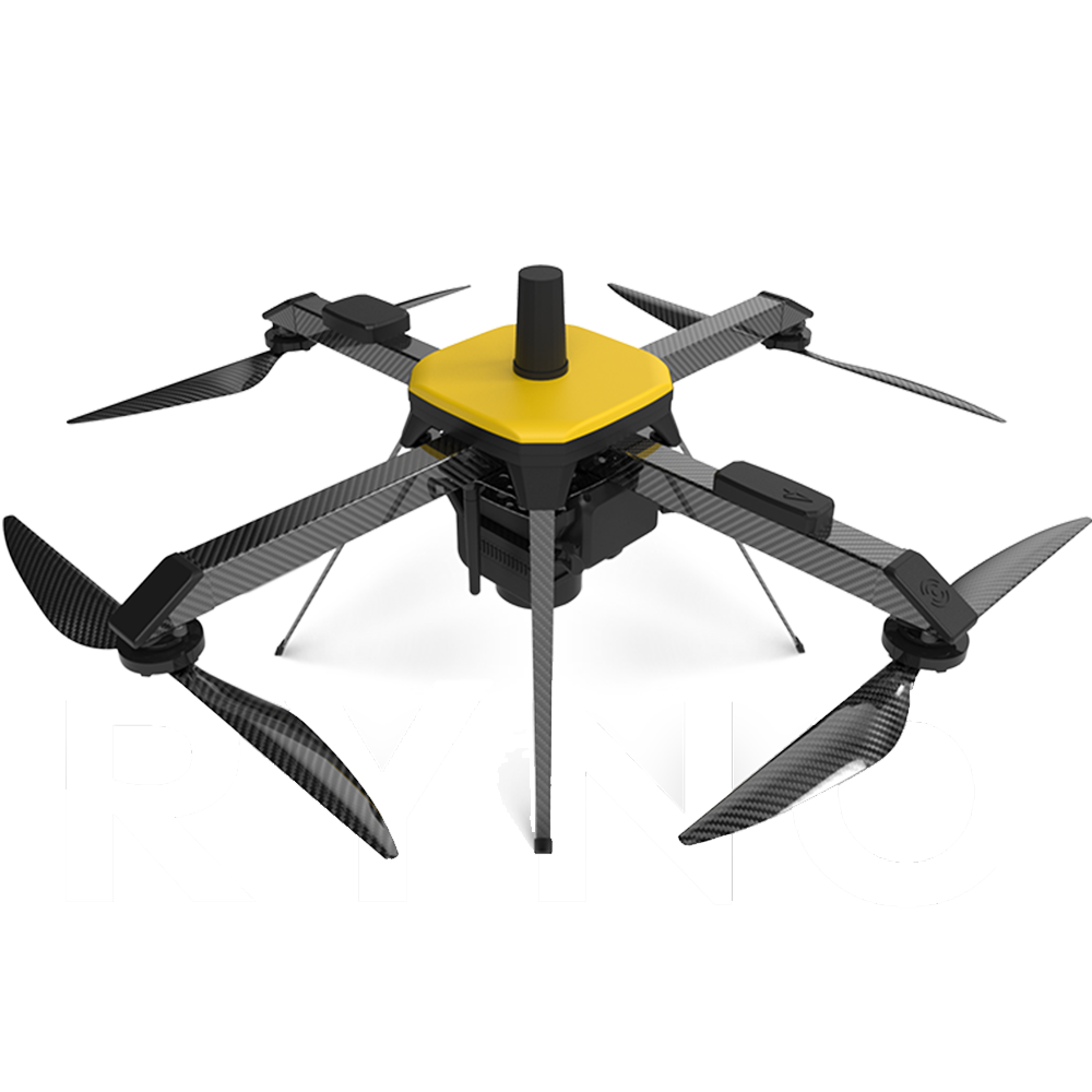
UAV WITH 20MP CAMERA WITH MAPPING PAYLOAD WITH 4KM RANGE AND 40 MINUTES FLIGHT TIME
₹2,025,000.00₹2,100,000.00 (-4%)
Store DRONES TECH LAB
In stock
MAPPING UAV is micro category survey-grade drone designed and specialized for mapping applications. It is equipped with an advanced mapping payload and state-of-the-art- PPK module to deliver superior results. Due to its high accuracy in mapping applications, it is the only micro category drone that has been approved by the Survey of India (SOI) towards the Swamitva Yojana, which is set to be one of the largest drone-powered mapping projects in the world.
Item will be shipped in 4-6 weeks
Compare
Frequently Bought Together
-

UAV WITH 20MP CAMERA WITH MAPPING PAYLOAD WITH 4KM RANGE AND 40 MINUTES FLIGHT TIME
₹2,025,000.00₹2,100,000.00(-4%) -
Total Price: ₹2,075,000.00Add All To Wishlist Browse Wishlist
- This item: UAV WITH 20MP CAMERA WITH MAPPING PAYLOAD WITH 4KM RANGE AND 40 MINUTES FLIGHT TIME(₹2,025,000.00
₹2,100,000.00(-4%)) - UGCS Pro(₹50,000.00
₹56,000.00)
TECHNICAL SPECS:
|
Aerial Vehicle (AV) Characteristics |
|
|
UAV Weight with battery and max. payload |
<2 Kg |
|
Range of live transmission (LOS) |
4 km (un-obstructed & |
|
Typical Cruise Speed |
10 m/s |
|
Functional Temperature Range |
-10°C to +50°C |
|
Dust & Drizzle Resistance |
IP53 rating |
|
Deployment Time |
<10 minutes |
|
Packaging and Storage |
Backpacks to carry all mission |
|
Regulatory Compliance |
NPNT Ready – applicable for Indian |
|
Base Station Characteristics |
|
|
GNSS Grade |
High accuracy L1 & L2 Frequency Band Enabled
|
|
Mapping Performance at 60m AGL |
|
|
Ground Sampling Distance (GSD) |
<3 cm |
|
Typical X, Y accuracy |
<5 cm |
|
Typical Z accuracy |
<10 cm |
|
Absolute X, Y accuracy |
<10 cm (with 95% confidence interval) |
|
Absolute Z accuracy |
<20 cm (with 95% confidence interval) |
|
Ground Control Station (GCS) Software features |
|
|
Terrain Avoidance |
Detects and avoids natural terrain by using elevation data (where |
|
Geo Tagging |
For accurate post processing |
|
Easy Take-Off/ Landing |
Ensures you concentrate on outcome |
|
Flight Planning |
For predictable and repeatable mapping operations |
|
Live Display of Flight Parameters |
To keep you updated every step of the way |
|
Encrypted Communications |
For highest privacy |
|
|
|
|
Communication Link Characteristic |
|
|
Autonomous Flight Termination System or Return Home (RH) option |
Return home triggered by land command on various fail safe features |
|
Fail Safe Features |
|
|
Multiple GPS on-board |
For Redundancy |
|
Auto-Return to Home and Land |
On Communication Failure |
|
Auto-Return to Home and Land |
On Low Battery |
|
Auto-Return to Home and Land |
On exceeding Wind limit of the system |
|
Auto-Return to Home and Land |
On Battery Imbalance |
|
Auto-Return to Home and Land |
On exceeding Temperature limit of the system |
Payloads:
The combination of mapping payload with PPK module is a powerhouse in itself. It delivers class-dominating accuracy that has never been seen before.
- >20 mega pixels Camera
- APS-C CMOS Sony sensor
- 64 Gb Storage (Expandable)
Additional information
| Weight | 0.005 kg |
|---|---|
| Dimensions | 0.001 × 0.001 × 2.95 cm |
Only logged in customers who have purchased this product may leave a review.
No more offers for this product!
General Inquiries
There are no inquiries yet.


Reviews
There are no reviews yet.