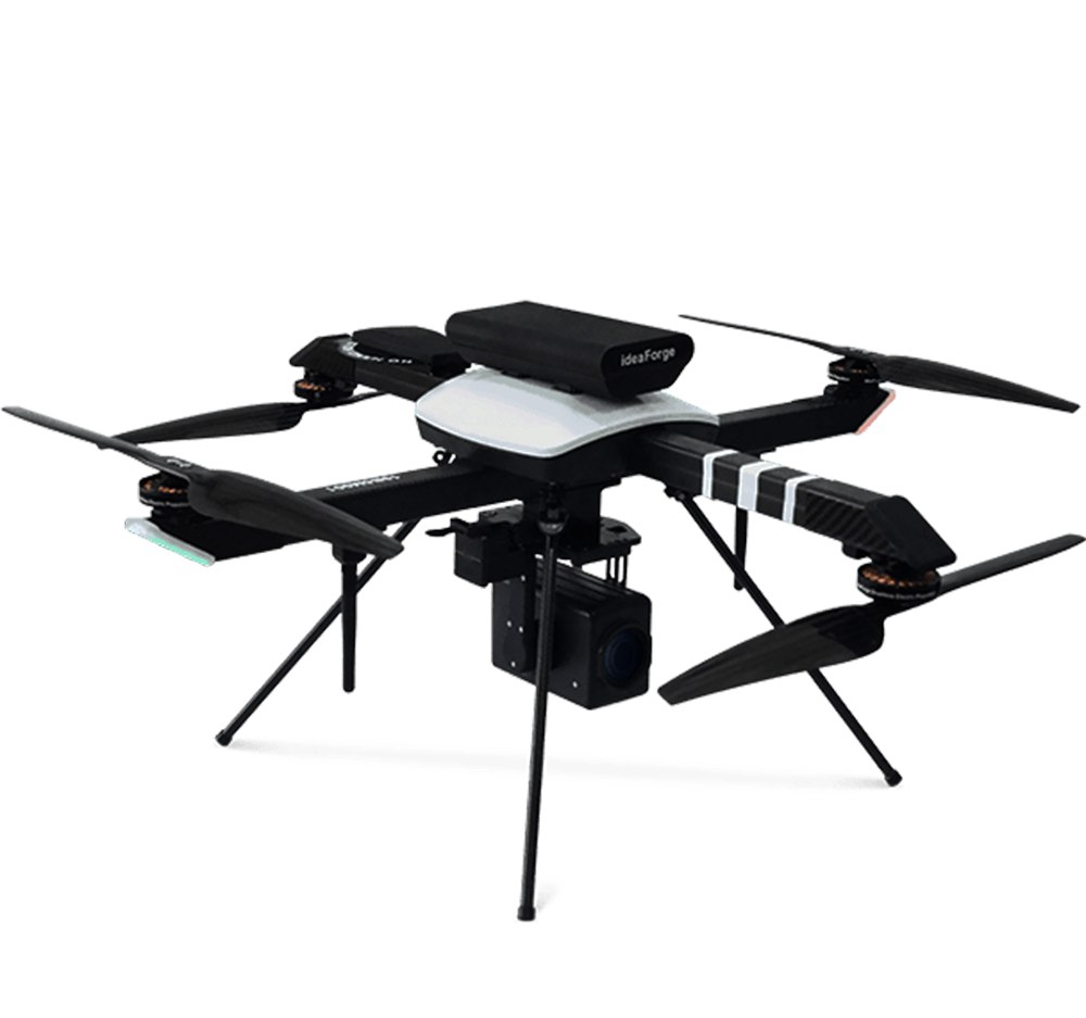
DGCA APPROVED DAY SURVEILLANCE QUADCOPTER WITH 2KM RANGE
₹335,000.00₹375,000.00 (-11%)
In stock
DGCA approved UAV is a lightweight & economical Micro UAV built for Surveillance. It is India’s most reliable NPNT compliant micro drone. With the lowest training requirement in the Industry to an NPNT compliant Autopilot, UAV is the most accessible professional Aerial Vehicle flying in Indian airspace.
Frequently Bought Together
-
Total Price: ₹375,000.00Add All To Wishlist Browse Wishlist
- This item: DGCA APPROVED DAY SURVEILLANCE QUADCOPTER WITH 2KM RANGE(₹335,000.00
₹375,000.00(-11%)) - UGCS Mapper(₹40,000.00
₹48,500.00)
Technical Specifications:
- UAV Weight with battery and standard payloads- < 2 Kg
- UAV Size with Propeller – < 1m x 1m
- Endurance/ Flight time (up to 1000m AMSL) – 20-25 minutes with Payload(s)
- Range for live transmission (Radius) – 2 km
- Typical Cruise Speed- 7 m/s
- Operating Altitude (AGL) – 200m AGL (Above Ground Level)
- Maximum Launch Altitude- 3000m AMSL (Above Mean Sea Level)
- Functional Temperature Range- 0°C to +40°C
- Wind Resistance – Minimum 12.5m/s (45kmph or 24.3knots).
Failsafe features:
- Return to Home on communication failure.
- Return to Home/Land on low battery or battery issues.
- Return to Home/Land on low battery or battery issues.
- Return to home on high winds (more than 12.5m/s).
- Multiple GPS on-board for GPS failure redundancy.
Autonomy: Fully autonomous from Take-off to Landing without using an R/C controller.
Payload Characteristics: HD (1280X720) quality with 5x optical zoom video
payload 1 axis gimbal.
Ground Control Station (GCs) Software Features:
Flight Modes–
- Altitude Hold.
- Hover at a defined waypoint.
- Autonomous Waypoint Navigation (pre-defined as well as dynamically adjustable waypoints during flight).
- Remotely Piloted mode for video-based navigation (RPV Mode).
-
Real-time Target Tracking of designated static and moving targets (Optional).
GUI Display Parameters:
- Geographic Map along with UAV location, UAV trajectory, camera view polygon, waypoints & flight plan.
- Real-time video from the UAV with on-screen display of important parameters like UAV co-ordinates, target (payload) co-ordinates and range from UAV, true North indication, Distance from HOME, etc.
- Real-time video displayed at all times during the flight.
- Artificial Horizon indicating UAV attitude.
Maps:
- Capability of working with Google Maps and/or other available open-source maps.
Application has the capability to download maps automatically after specifying location GPS co-ordinates. - Capability to integrate geo-referenced raster maps provided in at least one of the commonly used digital.
- Map formats (gif, tiff etc.).
User Controls:
- One-click Take-off/Land/Hover.
- Set altitude of the UAV.
Joystick Controls:
- Waypoint navigation.
- Dynamic flight plan adjustment.
- Point payload to ground co-ordinate function.
- RPV Mode which allows UAV to be flown in semi- autonomous mode by looking at the on-board video.
- Full camera controls Pan/Tilt & Zoom In & Out.
- RPV mode.
- Altitude control.
Video:
- Video recorded in commonly portable video format (AVI/MP4 etc.) on the GCS. The UAV does not do any on-board recording.
- Video of the full flight is recorded by default with option to turn recording off.
- Capability of taking image snapshots with on- screen display parameters at any time during flight.
Pre-flights checks: Capability to perform pre-flight checks of the complete system before every flight for confirming the suitability of flightworthiness.
Communication link characteristics:
- Secure Communication link between UAV and GCS with minimum 128bit encryption.
- Frequency band- 2.4GHz or 5GHz up-link and down-link.
Additional information
| Weight | 0.005 kg |
|---|---|
| Dimensions | 0.001 × 0.001 × 2.95 cm |
Only logged in customers who have purchased this product may leave a review.
General Inquiries
There are no inquiries yet.


Reviews
There are no reviews yet.